

The Invisible High-Road: Navigating the Regulatory and Technical Maze of Global Drone Traffic
- krdroneworks
- Dec 30, 2025
- 4 min read
By: Colonel (ret) Bernie Derbach, KR Droneworks, 30 Dec 25

The hum of a drone overhead, once a rare curiosity, is rapidly becoming a familiar soundtrack of modern life. From delivering packages to inspecting infrastructure and even assisting in search and rescue operations, drones are poised to revolutionize countless industries.
Yet, as these unmanned aerial vehicles (UAVs) transition from individual novelties to ubiquitous commercial fleets, a monumental challenge emerges: managing the sheer volume and complexity of their flight paths. The "Wild West" era of unregulated drone flight is drawing to a close, replaced by a sophisticated, digital architecture known as Unmanned Traffic Management (UTM).
By 2030, the drone industry is projected to handle millions of flights annually, a staggering figure that underscores the urgent need for a robust and intelligent system to prevent chaos in our skies. This isn't just about avoiding collisions; it's about optimizing routes, ensuring safety, and integrating these aerial workhorses seamlessly into existing airspace.
The Birth of UTM: A Digital Air Traffic Control
Imagine an airspace volume so dense with activity that human air traffic controllers, no matter how skilled, would be overwhelmed. This is the future UTM is designed to manage. In 2025, we are witnessing the pivotal birth of this new digital architecture, one that promises to be as transformative for drones as traditional air traffic control was for manned aviation.
UTM is more than just a software solution; it's an ecosystem. It encompasses a complex interplay of hardware, software, regulations, and communication protocols designed to provide real-time situational awareness, conflict resolution, and dynamic airspace management for drones operating at low altitudes. Unlike its manned aviation counterpart, which relies heavily on human intervention, UTM leverages automation, artificial intelligence, and advanced data analytics to orchestrate a safe and efficient flow of drone traffic. This includes everything from flight planning and authorization to tracking, dynamic rerouting, and emergency management.

From Geofencing to "Operator Responsibility": A Paradigm Shift
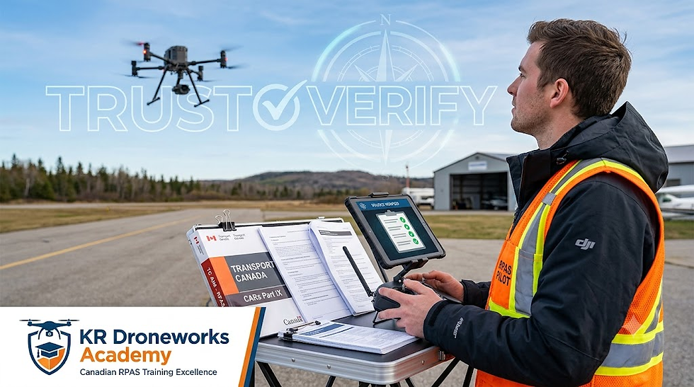
For the past decade, a primary method of ensuring drone safety, particularly around sensitive areas like airports, has been proprietary geofencing. Manufacturers like DJI embedded "no-fly zones" directly into their drone software, physically preventing the UAVs from taking off or entering restricted airspace. While effective in its simplicity, this approach often created significant bottlenecks. Emergency responders needing to deploy drones in restricted areas, or commercial operators with legitimate waivers, faced frustrating delays as they sought to "unlock" their devices.
However, a significant industry shift is now well underway. As of late 2025, leading drone manufacturers are phasing out these rigid, manufacturer-controlled blocks in favor of "Enhanced Warning Zones." This represents a profound philosophical change: the primary legal responsibility for safe flight now rests squarely with the pilot, not the software.

How Enhanced Warning Zones Work
Under this new model, drones leverage real-time data feeds from national aviation authorities such as the FAA in the United States or EASA in Europe. When a drone approaches or is within a restricted or sensitive airspace, the operator receives prominent, in-app warnings detailing the specific restrictions and potential hazards. These warnings are often accompanied by clear visual indicators on the drone's control interface, providing immediate and actionable information.

The critical difference is that, with proper legal authorization (e.g., an approved waiver from the FAA), the operator is now permitted to proceed with the flight despite the warning. This empowers authorized pilots to operate more efficiently without being held captive by a manufacturer's default settings. It streamlines operations for vital services like emergency services, where quick deployment can save lives, and for commercial enterprises operating under specific regulatory frameworks.
The Interconnected Web of UTM and Operator Responsibility
This shift to operator responsibility is not a step backward for safety; rather, it’s an evolution towards a more intelligent, adaptable, and scalable system. It integrates seamlessly with the broader goals of UTM:
Dynamic Airspace Management: UTM systems can issue dynamic advisories and temporary flight restrictions (TFRs) in real-time, which are then reflected in the Enhanced Warning Zones. This allows for rapid adaptation to changing conditions, such as sudden weather events or emergency operations.
Increased Accountability: By placing the onus on the operator, it reinforces the need for thorough flight planning, adherence to regulations, and continuous training. Pilots must be fully aware of their operational environment and any specific authorizations required.
Data-Driven Decisions: UTM relies on vast amounts of data—flight plans, real-time telemetry, weather information, and airspace restrictions—to make informed decisions. Enhanced Warning Zones are a direct manifestation of this data being delivered directly to the pilot.
Facilitating Commercial Operations: For the drone industry to truly flourish, it needs a system that can accommodate complex commercial operations. The previous geofencing model, while simple, often stifled innovation and efficiency. The new approach allows for greater flexibility and scalability, crucial for applications like drone delivery networks and large-scale industrial inspections.

The Invisible High-Road: Navigating the Regulatory and Technical Maze of Global Drone Traffic
The hum of a drone overhead, once a rare curiosity, is rapidly becoming a familiar soundtrack of modern life. From delivering packages to inspecting infrastructure and even assisting in search and rescue operations, drones are poised to revolutionize countless industries. Yet, as these unmanned aerial vehicles (UAVs) transition from individual novelties to ubiquitous commercial fleets, a monumental challenge emerges: managing the sheer volume and complexity of their flight paths. The "Wild West" era of unregulated drone flight is drawing to a close, replaced by a sophisticated, digital architecture known as Unmanned Traffic Management (UTM).
By 2030, the drone industry is projected to handle millions of flights annually, a staggering figure that underscores the urgent need for a robust and intelligent system to prevent chaos in our skies. This isn't just about avoiding collisions; it's about optimizing routes, ensuring safety, and integrating these aerial workhorses seamlessly into existing airspace.


Comments