

Mastering the E6-B Flight Computer for Level 1 Complex Drone Operations
- krdroneworks
- Nov 22, 2025
- 7 min read
Updated: Dec 2, 2025
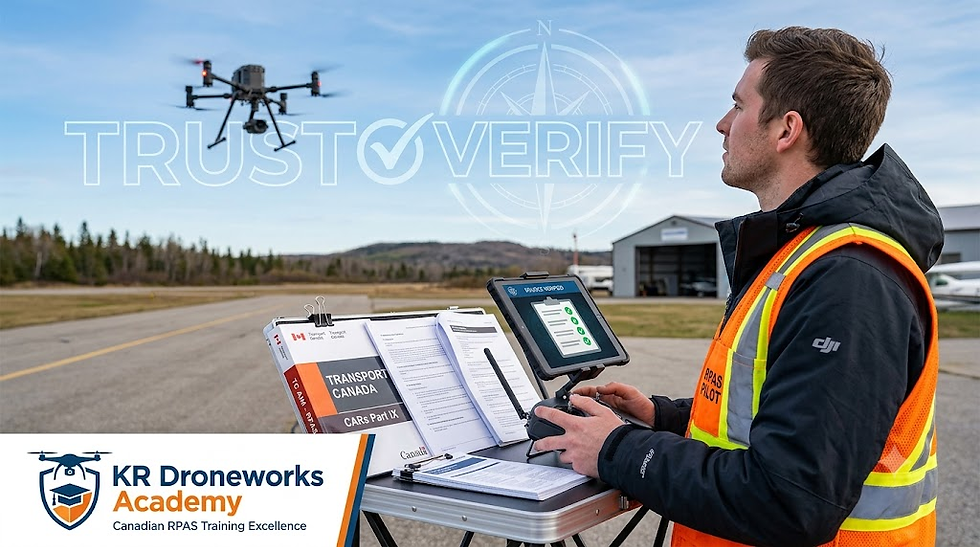
For Level 1 Complex drone pilots operating under Canadian regulations effective as of November 2025, the E6-B flight computer is an essential tool for flight planning and risk management.
While originally designed for manned aviation, the E6-B helps Level 1 Complex pilots tackle the unique challenges of Beyond Visual Line of Sight (BVLOS) operations. Unlike Visual Line of Sight (VLOS) flying, where you can visually assess if wind is pushing your drone off course, BVLOS requires mathematical calculations of headings and ground speeds. This ensures your drone remains within its approved operational volume.
The E6-B's Role in BVLOS Operations
The E6-B provides several critical functions for Level 1 Complex operations:
1. Precise Wind Correction (Critical for BVLOS)
In BVLOS operations, you must ensure your drone stays within a defined geographic "box" (Operational Volume) and does not drift into the "Ground Risk Buffer." The E6-B allows you to calculate the Wind Correction Angle (WCA).
The Problem: If you command a drone to fly North (360°) and there is a 20 km/h wind from the West, the drone will drift East.
The E6-B Solution: By inputting your drone's airspeed and the wind speed/direction, the E6-B tells you how many degrees to "crab" (turn) into the wind to fly a straight ground track. This ensures you don't accidentally violate airspace or fly over populated areas you planned to avoid.
2. Battery Endurance Calculations (The "Fuel" Calculation)
The E6-B features a "fuel consumption" calculator that works perfectly for batteries if you substitute Amps for Gallons/Liters.
The Problem: You know your battery capacity (e.g., 10,000 mAh or 10 Ah) and your average draw (e.g., 25 Amps), but you need to know exactly how many minutes you can fly.
The E6-B Solution: Set the "rate" arrow to your current draw (25). Read the capacity (10) on the outer scale, and the inner scale will give you the exact endurance in minutes. This helps you establish a "Bingo Battery" time—the exact moment you must turn back to land safely.
3. Ground Speed vs. True Airspeed
For Level 1 Complex missions involving long distances (e.g., pipeline inspection or mapping), the speed you command the drone to fly (Airspeed) is rarely the speed it travels over the ground (Ground Speed).
Tailwind: Your drone arrives sooner than expected (monitoring implication: you might overshoot a waypoint).
Headwind: Your drone moves slower over the ground.
The E6-B Solution: It calculates your actual Ground Speed. You can then use this to accurately predict your Estimated Time En Route (ETE). If your battery lasts 20 minutes, but a headwind slows your ground speed to 10 km/h, the E6-B will tell you immediately if you can reach your destination and return.
4. Radius of Action (Safe Return Distance)
Level 1 Complex pilots often need to know: "How far out can I fly and still have enough battery to get back, considering the wind?"
The E6-B Solution: There is a specific E6-B formula for "Radius of Action" that accounts for the fact that a headwind outbound becomes a tailwind inbound (and vice versa). It gives you a mathematically safe "turn-back" distance, which is critical for proving to Transport Canada or your flight reviewer that you are operating safely.
5. Unit Conversions
Aviation weather (METARs/TAFs) provided by NAV CANADA often uses Knots for wind speed and Statute Miles for visibility, while your drone software likely uses Meters/Second or Kilometers/Hour.
The E6-B Solution: The circular slide rule face has built-in conversion markers. You can instantly convert a "15 Knot wind" from a forecast into "28 km/h" or "8 m/s" to check if it exceeds your drone's maximum wind resistance limits.
6. Validating Automation
While flight planning software (like Mission Planner or DJI Pilot 2) calculates these figures automatically, Level 1 Complex pilots are expected to have "systems understanding."
The Function: Using an E6-B allows you to "sanity check" the software's pathing. If the software says a mission is possible but your E6-B calculation shows you'll land with 2% battery due to a headwind, the manual calculation saves the drone.
Summary Table for Level 1 Complex Pilots
Drone Function | E6-B Feature to Use | Application |
Course Holding | Wind Side (Back) | Calculate Heading needed to maintain a straight Track over the ground. |
Battery Planning | Calculator Side (Front) | Convert Amps (Rate) + Capacity (Quantity) = Flight Time (Endurance). |
Mission Timing | Calculator Side (Front) | Convert Ground Speed + Distance = Time En Route. |
Weather Checks | Conversion Scales | Convert Knots (weather report) to m/s (drone limit). |
Practical Application: Radius of Action Calculation
Here is a classic flight planning problem. In a Radius of Action scenario, you are flying a "Boomerang" mission: flying out to a point and returning to the same spot.
The challenge is that wind affects you differently on each leg. If you fly into a headwind going out, you travel slowly. Turning around, you have a tailwind and travel fast. You cannot simply fly for "half your battery time" outbound, or you will run out of power on the return leg.
The Scenario
Imagine you are inspecting a power line using a fixed-wing VTOL drone.
True Airspeed (TAS): 60 km/h (The speed the drone flies through the air).
Wind: 20 km/h coming directly from the North (Headwind outbound).
Safe Battery Endurance: 30 minutes (This is your total flight time minus your safety buffer).
Goal: How far North can you fly (in km) before you must turn around?
Phase 1: Find Your Ground Speeds (Wind Side)
First, you must determine your actual speed over the ground for both the outbound and inbound legs.
Set the Wind: On the wind side (the sliding grid), align the wind direction (North/360) under the "True Index" mark. Mark the wind velocity up from the center grommet (20 units).
Outbound Leg (Headwind):
Rotate the compass ring to your heading (North/360).
Slide the grid so your Airspeed (60) is under the wind dot.
Read the Ground Speed at the center grommet.
Result: Since it is a direct headwind, it is simple math: 60 - 20 = 40 km/h (GS Out).
Inbound Leg (Tailwind):
Rotate the compass ring to the return heading (South/180).
The wind dot is now below the grommet (pushing you).
Result: 60 + 20 = 80 km/h (GS In).
Phase 2: The Radius of Action Formula
While you can do the multiplication on the slide rule side, it is often faster to plug the numbers from Phase 1 into the standard aviation formula used for this calculation.
The formula is:

Note: Ensure your Endurance is in Hours to match your speed (km/h).
30 minutes = 0.5 hours.
Phase 3: The Calculation
Now, we solve the equation using the numbers we found.
Calculate the Speed Ratio:
40 X 80 = 3200
40 + 80 = 120
Divide:
3200/120 = 26.66
(This number, 26.66 km/h, is effectively your average ground speed for the loop).
Multiply by Endurance:
0.5 hours X 26.66 = 13.3 km
The Result
You can fly 13.3 km North. Once you hit that distance, you must turn around.
Why This Matters (The Verification)
Let's double-check the math to prove why this is safer than just flying "15 minutes out."
The Outbound Leg: Flying 13.3 km at 40 km/h takes 20 minutes.
The Return Leg: Flying 13.3 km at 80 km/h takes 10 minutes.
Total Flight Time: 20 + 10 = 30 minutes.
If you had just flown 15 minutes out (which would be 10 km), you would have been safe, but you would have under-utilized your battery. However, if the wind had been reversed (Tailwind out), flying 15 minutes out would have pushed you so far away that you couldn't make it back against the wind!
For Level 1 Complex operations, simply remember that Time is not symmetrical when wind is present.
Use the Wind Side to get your Ground Speed Out and Ground Speed In.
Use the Formula to get the distance.
Real-World Scenario: Crosswind Considerations
Here is a much more realistic "real-world" scenario. In a crosswind, your drone must fly at an angle (crab) to stay on a straight line.
Here is the critical concept for Level 1 Complex pilots:
Crabbing "eats" energy. Because the drone is using some of its thrust just to fight the sideways push of the wind, your Ground Speed will decrease even if the wind is purely from the side (90°).
The Scenario: Pipeline Inspection
True Airspeed (TAS): 60 km/h.
Wind: 20 km/h from the North-West (315°).
Course: You need to track straight North (360°).
Endurance: 30 minutes (0.5 hours).
Phase 1: Outbound Leg (Flying North)
You need to find two things:
Ground Speed (GS): How fast you are actually moving North.
Heading: Which way to point the nose so you don't drift East.
The E6-B Steps:
Set the Wind: Rotate the azimuth ring to 315 (Wind Direction). Mark the wind velocity (20 units) up from the center grommet.
Set the Course: Rotate the ring to 360 (Your desired track).
Find the Solution:
Slide the grid until the Wind Dot rests on the curve representing your TAS (60).
Read Ground Speed: Look at the center grommet. It should read approximately 44 km/h.
Read WCA (Wind Correction Angle): Look at the Wind Dot's horizontal position. It is to the left of the center line by roughly 14 degrees.
Outbound Data:
GS Out: 44 km/h.
Heading: 346° (360° minus 14° correction to the left).
- Note: If you didn't correct for this, your drone would get blown off the pipeline easement immediately.
Now you turn around to come home.
The E6-B Steps:
Set the Course: Rotate the ring to 180 (South).
Find the Solution:
You do not need to re-mark the wind. Just slide the grid.
Ensure the Wind Dot is on the TAS (60) line.
Read Ground Speed: The grommet will now read approximately 72 km/h (You have a tailwind component now).
Read WCA: The dot is now to the right, meaning you must crab to the right (West) to stay on the line.
Inbound Data:
GS In: 72 km/h.
Now We Determine How Far Out You Can Fly on That Pipeline Before Turning Back
Formula:
The Math:
Multiply Speeds: 44 X 72 = 3168
Add Speeds: 44 + 72 = 116
Divide: 3168/116 approx 27.3 (Average loop speed)
Multiply by Endurance: 0.5 hours X 27.3 = 13.65 km
Notice something interesting compared to a "pure" headwind?
Pure Headwind/Tailwind (Previous example): GS Out 40, GS In 80.
Crosswind Scenario (This example): GS Out 44, GS In 72.
Even though the wind speed was the same (20 km/h), the Crosswind component required you to turn the drone 14° into the wind. This reduced your effective forward speed on both legs compared to a scenario with no wind.
Safety Tip
If you fly a fixed-wing drone (like a Trinity or Wingtra) in a high crosswind, your software will usually handle the crab angle, but it cannot change the physics of battery consumption. The E6-B calculation proves that crabbing reduces your range.


Comments